Wetland Delineation and Monitoring
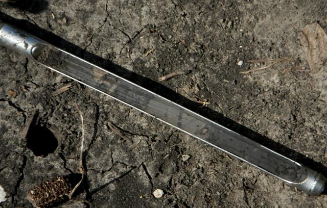
Shown above: soil sample from a mitigation wetland, showing the development of hydric soils.
Wetland Delineation is a regulatory requirement of the US Clean Water Act and the Food Security Act ("farm bill"). In brief, Delineation is the discovery and mapping of a wetland area, using aerial imagery, field assessments of botany, hydrology, and soils, GPS mapping, and related techniques. Mapping consists of the location of the boundary between a wetland and non-wetland in order to determine the area that will be impacted and that must be replaced or "mitigated" by the client.
Leeward uses field GPS units and GIS systems to map wetland boundaries, along with field botany, knowledge of hydrology, and soils to accomplish competent delineations ahead of your project. Monitoring of mitigation wetlands occurs with the same precision and understanding of US EPA and Army Corps of Engineers requirements for field observations and reporting. The region of competence includes the entire state of Iowa and bordering portions of neighbor states where vegetation, hydrology, and soils are similar.
Wetland Monitoring uses the same methods to evaluate an existing wetland that was created as a mitigation requirement because a natural wetland was destroyed. Monitoring takes place over a period of time, often five years, with at least one site visit annually to assess the progress of the artificial wetland toward wetland status. By the end of the required assessment period the created wetland should meet or exceed the criteria defined in the farm bill and US Army Corps of Engineers delineation manual for the appropriate region.
Useful links to information at other web sites about wetland delineation & monitoring. Click on the resource name.
US Army Corps Wetland Delineation Manuals, including the 2012 Midwest Supplement
National Wetland Plant Lists, by region and state
NRCS Field Indicators for Hydric Soils (2010)